




Hurricane Wilma was a record-breaking storm when it made landfall Oct. 24, 2005, in Collier County. Since then, some of its intensity records have been surpassed by other powerful hurricanes, but Wilma still remains one for the record books 20 years later.
Wilma was notable for its fast movement, intensity and especially its major drop in barometric pressure, said Dan Summers, the director of the Collier County Emergency Management Department for more than two decades.
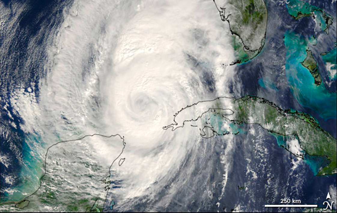
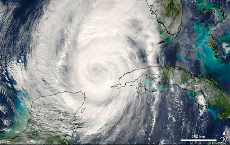
When the Moderate Resolution Imaging Spectroradiometer on NASA’s Terra satellite took this image of Hurricane Wilma on Oct. 23, 2005, the hurricane was regaining some power as it crossed the Gulf’s warm waters and its outer edges were just starting to reach Southwest Florida.
Summers remembers the point when the county’s emergency operations center received information about Wilma’s low barometric pressure.
“For those of us who have been in this line of work, we all got goosebumps, and our hair stood up on the back of our neck when we saw that tremendous barometric drop, which is indicative of some difficult days to come,” Summers said.
Wilma surged from a tropical storm to a Category 5 hurricane in record time on the same day before striking the Yucatan Peninsula of Mexico and making its way toward Southwest Florida.

Powerful waves batter the Naples Pier as Hurricane Wilma approaches Southwest Florida on Oct. 24, 2005. The storm made landfall near Cape Romano as a Category 3 hurricane.
Tale of the tape
Wilma struck Cape Romano south of Marco Island as a 120 mph Category 3 hurricane on the morning of Oct. 24, 2005.
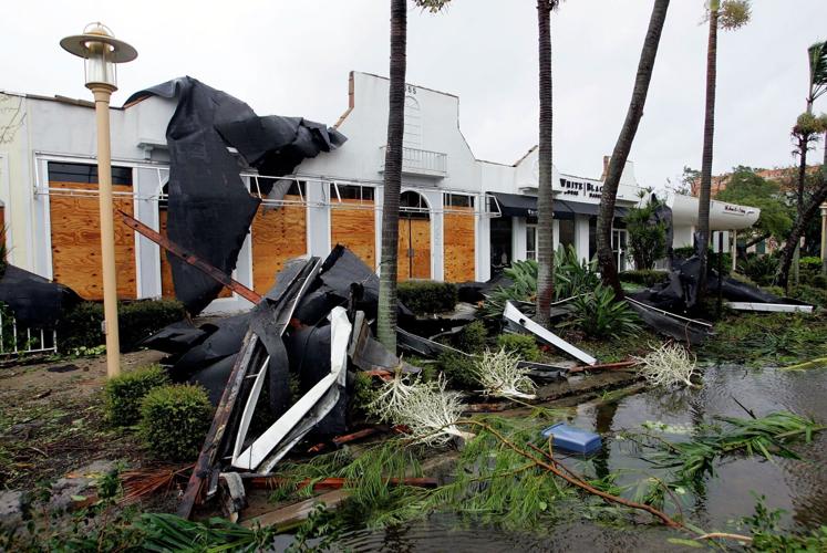
Damage was widespread with large trees and power lines down everywhere, causing more than 3 million customers to lose power in Florida. Even high-rise condominium buildings along the coast in Naples suffered considerable damage because of broken windows. In Naples, Wilma had maximum sustained winds of 61 mph, while maximum peak winds were recorded at 82 mph, although records are incomplete because of instrument failure.
One confirmed tornado with an F1 intensity was observed in rural Collier County around 2:30 a.m. on Oct. 24, moving rapidly northwest from the intersection of U.S. 41 and State Road 29 to the town of Copeland 3 miles to the north, the National Weather Service reports. The twister spawned from the hurricane snapped power poles, uprooted large trees and significantly damaged mobile homes.
Rainfall amounts were 4 to 6 inches across coastal Collier County. The maximum storm surge across the area was mostly south of Chokoloskee, but Chokoloskee experienced extensive flooding with a storm surge of at least 7 feet. A storm surge of around 7 feet also was estimated on Marco Island, with 4 feet in Everglades City, according to the National Weather Service.
Although Wilma’s double whammy of wind and water on the Collier coast was eclipsed in the last decade, Wilma stood out in the early years of the 21st century.
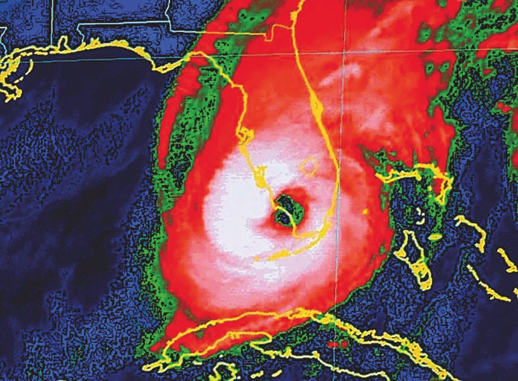
Satellite imagery shows Hurricane Wilma approaching Southwest Florida on Oct. 24, 2005. The storm made landfall near Cape Romano with 120 mph winds, becoming one of the most intense hurricanes on record in the Atlantic basin.
“Well, I think really the Wilma event was the original eye-opener or a refresher, if you will, to storm surge inundation,” Summers said. “We feel like people associate hurricanes as just a wind event, and Wilma certainly brought that storm surge that got people’s attention. That event was kind of the wakeup call for storm surge potential in Southwest Florida.”
Wilma exhibited a huge 55- to 65-mile-wide eye while crossing the state, covering large portions of South Florida, including the eastern two-thirds of Collier County. The eye wall’s strongest winds affected all of South Florida.
“An interesting and revealing aspect of Wilma was the wind field in the eye wall. The winds on the back (southwest) side of the eye wall were as strong, if not stronger, than those on the front (northeast) side. This goes against the common, but sometimes erroneous, belief that the strongest winds in a hurricane are always in the right-front quadrant of the storm,” the National Weather Service reports.
Wilma’s late-October landfall also was a rarity for Southwest Florida, but the fall weather had a silver lining of sorts, according to Summers.
“One thing that stood out in my mind is that we had cold temperatures for almost two weeks after that, and that made our recovery so much easier,” he said. “People were able to shelter in place and stay in their homes. I know that we had apartment buildings and things without power that were dry, but because the heat and the humidity dissipated pretty quick after that storm, made our recovery much easier.”
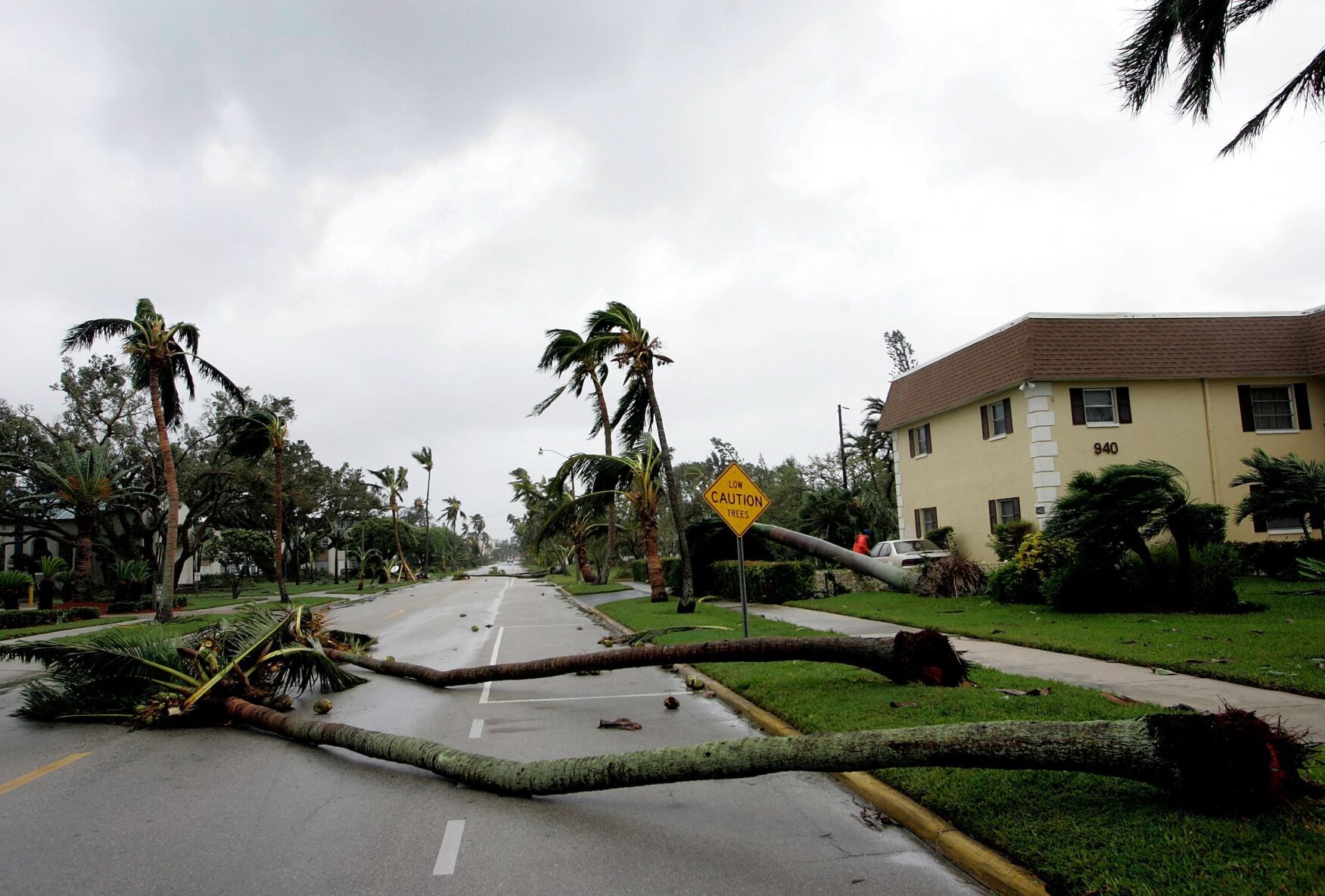
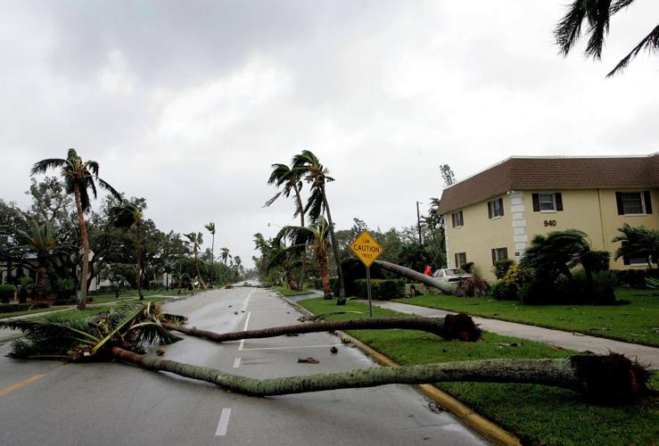
Downed palm trees block a street in Collier County after Hurricane Wilma swept through Southwest Florida in October 2005, bringing winds up to 135 mph in some areas.
Never-ending season
The 2005 hurricane season also tied the record as a year with the most named storms, 27 total, set in 1933. Not only did the National Hurricane Center exhaust its list of standard alphabetical names, with late-season Wilma being the last, the extensive season continued with the Greek alphabet names of Alpha, Beta, Gamma, Delta, Epsilon and Zeta.
Because of their devastating impacts that year, Wilma and four other storm names — Dennis, Katrina, Rita and Stan –— were retired from the World Meteorological Organization’s lists of hurricane names that are rotated every six years. The 2005 record number of storms was broken 15 years later in 2020 with a season of 30 named storms.
All quiet on the Atlantic front
Ironically, this year’s season is notable for its lack of storms. With five weeks left in the 2025 season, the mere mention of it being so quiet has superstitious folks knocking on wood.
If calm conditions continue, this season could be one for the record books.
But, of course, hurricane season runs through Nov. 30, so “it ain’t over till it’s over,” as baseball legend Yogi Berra is famously quoted as saying.
(0) comments
Welcome to the discussion.
Log In
Keep it Clean. Please avoid obscene, vulgar, lewd, racist or sexually-oriented language.
PLEASE TURN OFF YOUR CAPS LOCK.
Don't Threaten. Threats of harming another person will not be tolerated.
Be Truthful. Don't knowingly lie about anyone or anything.
Be Nice. No racism, sexism or any sort of -ism that is degrading to another person.
Be Proactive. Use the 'Report' link on each comment to let us know of abusive posts.
Share with Us. We'd love to hear eyewitness accounts, the history behind an article.